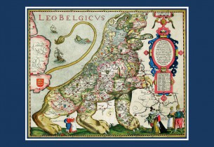
“The Basque Country seen from Flanders and Europe. Antique Cartography of the XVI and XVII Centuries” is the title of the cartography exhibition to be held by Bilbao Maritime-River Museum until 31 January before moving to the Permanent Collection.
The exhibits include three original documents – the Leo Belgicus, the BiscayenPars (I) and the Europa Polyglotta Maps – as well as reproductions of the highest quality. Together with the maps, a selection of books is offered that reinforce the idea of the importance of the Basques and their language in the European panorama, which was due to the existence of a port like that at Bilbao.
The Museum, with this exhibition, is taking part in the IV International Engraving Fair being held in Bilbao.

 Port access
